Service
FEMA ELEVATION CERTIFICATION
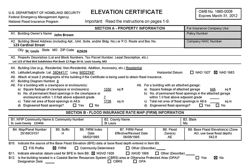
When buying a parcel of land in proximity to a 100-year flood plain, you may be asked to provide an elevation certificate to determine how much flood insurance (if any) you are required to have. The government has identified and mapped certain areas of land that are prone to flooding.
Land upon which flooding is expected to occur within 100 years is considered a Special Flood Hazard Area (SFHA), and FEMA requires any parcel of land purchased in these zones to carry flood insurance as prescribed by the National Flood Insurance Program (NFIP).

WHEN IS A FEMA ELEVATION CERTIFICATION NEEDED?
- If you are making significant structural changes on the property
- If there is no EC on file because the FIRM maps were not drawn or in force the last time the property changed hands
- If the FIRM maps have been recently updated to include your property (in other words, your land is now on a flood plain when it was not previously)
- If you suspect that your property’s flood rating has changed, and you want to request a letter of map amendment (LOMA) to change its status
NOTE: If the residential lot in question has a current elevation certificate (EC) on file and no changes need to be made, you may not be asked for a new one in order to obtain flood insurance.
WHAT TO EXPECT WITH A FEMA ELEVATION CERTIFICATION
- Survey crew will review the current FIRM maps for your property
- Survey crew will arrive on your property to conduct a field analysis and collect all required data
- IronStone Surveying will complete your FEMA elevation certificate to determine whether flood insurance is needed and what the premiums will be.

