Service
TOPOGRAPHIC / TREE LOCATION SURVEY
There are times you need more specific and detailed information about the trees on your land. Most jurisdictions require information about the location of trees with a 6” Diameter at Breast Height (DBH) and above.

WHEN DO YOU NEED A TOPOGRAPHIC/TREE LOCATION
- Planning a building project and need to know which trees to keep and which to remove
- To comply with local ordinances or HOA covenants about the number of trees on your land, and/or whether any can/should be removed
- Some real estate transactions / lenders may require a Tree Survey
- To clarify with a neighbor as to who owns a tree near your property boundary
- To have an inventory of the trees on your land and their density, for forestry preservation, runoff management, or in compliance with local rules and regulations.
WHAT TO EXPECT WITH A TOPOGRAPHIC SURVEY WITH TREE LOCATION
- Survey crew will arrive at the property to collect data, flag corners and re-set missing pins
- Survey crew will locate all natural and man-made features (streams, buildings roads etc.)
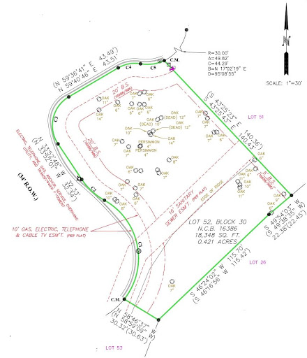
- Survey crew will locate, mark and identify the trees on the property ( >6” DBH )
- Survey crew will collect vertical elevation data of the property
- A scaled drawing (or “plat”) is drawn showing:
- Property lines, bearings, distances and acreage.
- Property improvements such as buildings, driveways, fences, pools, etc.,
- Location, size and species of property trees
- Property features and vertical elevations
- Any encroachments that might exist will be shown.

